モコトロング県
モコトロング県(Mokhotlong)は、10あるレソトの県のうちの一つ[1]。面積は4,075 km2で(2006年時点)、人口は約100,422人である(2016年時点)[2]。 県都はモコトロング[1]。県内にはマロティ山脈といった高地や、センク川の源流がある。レソトで最も貧しく辺鄙な場所であり田舎である[1][3]。
Mokhotlong | |
|---|---|
|
県 | |
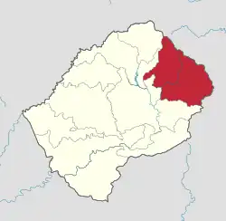 Map of Lesotho with the district highlighted | |
| 国家 |
|
| 面積 | |
| • 陸地 | 1,573 mi2 (4,075 km2) |
| 人口 (2016) | |
| • 合計 | 100,422人 |
| • 密度 | 60人/mi2 (24人/km2) |
| 等時帯 | UTC+2 (CAT) |
- “Lesotho - Mokhotlong”. www.lesotho-info.co.za. 2023年6月22日閲覧。
- “Mokhotlong - レソト | データと統計 - knoema.com”. Knoema. 2023年6月22日閲覧。
- “Mokhotlong - Lesotho - Area Database - Global Data Lab”. globaldatalab.org. 2023年6月22日閲覧。
This article is issued from Wikipedia. The text is licensed under Creative Commons - Attribution - Sharealike. Additional terms may apply for the media files.