サン・フランシスコ・デ・マコリス
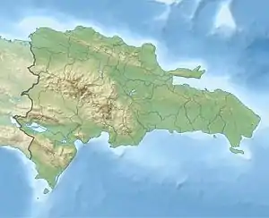
サン・フランシスコ・デ・マコリス(スペイン語: San Francisco de Macorís)は、ドミニカ共和国北中部のドゥアルテ州の州都。 2010年の人口は13万2725人[5]で、国内8位。 シバオ地方に属する[6]。
サン・フランシスコ・デ・マコリス | ||
|---|---|---|
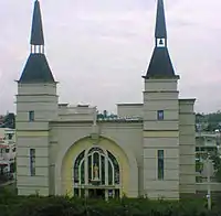
 マコリックスの中心地 | ||
| ||
 サン・フランシスコ・デ・マコリス | ||
| 座標:北緯19度18分0秒 西経70度15分0秒 | ||
| 国 | ドミニカ共和国 | |
| 州 | ドゥアルテ州 | |
| 建設 | 1497年[1] | |
| 市制 | 1844年 | |
| 面積 | ||
| • 合計 | 727.15 km2 | |
| 標高 | 110 m | |
| 人口 | ||
| • 合計 | 132,725人 | |
| • 密度 | 180人/km2 | |
| 住民呼称 | Francomacorisano(a) | |

概要
地名の由来
「サン・フランシスコ・デ・マコリス」は、フランシスコ会の守護聖人「アッシジのフランチェスコ」のスペイン語読みと、この地域の古い地名の「マコリックス」を合わせて作られた。
地理
気候
| サン・フランシスコ・デ・マコリス(1961年~1990年)の気候 | |||||||||||||
|---|---|---|---|---|---|---|---|---|---|---|---|---|---|
| 月 | 1月 | 2月 | 3月 | 4月 | 5月 | 6月 | 7月 | 8月 | 9月 | 10月 | 11月 | 12月 | 年 |
| 最高気温記録 °C (°F) | 37.2 (99) |
35.0 (95) |
36.5 (97.7) |
37.4 (99.3) |
37.5 (99.5) |
37.5 (99.5) |
38.0 (100.4) |
38.5 (101.3) |
39.5 (103.1) |
39.6 (103.3) |
38.5 (101.3) |
39.5 (103.1) |
39.6 (103.3) |
| 平均最高気温 °C (°F) | 28.3 (82.9) |
28.7 (83.7) |
29.6 (85.3) |
30.5 (86.9) |
30.9 (87.6) |
31.7 (89.1) |
31.9 (89.4) |
32.0 (89.6) |
32.2 (90) |
31.9 (89.4) |
29.9 (85.8) |
28.6 (83.5) |
30.5 (86.9) |
| 平均最低気温 °C (°F) | 17.7 (63.9) |
17.4 (63.3) |
17.7 (63.9) |
18.7 (65.7) |
20.0 (68) |
20.6 (69.1) |
20.8 (69.4) |
20.6 (69.1) |
20.5 (68.9) |
20.1 (68.2) |
19.4 (66.9) |
18.4 (65.1) |
19.3 (66.7) |
| 最低気温記録 °C (°F) | 12.2 (54) |
12.0 (53.6) |
10.2 (50.4) |
12.3 (54.1) |
14.0 (57.2) |
16.0 (60.8) |
12.9 (55.2) |
16.0 (60.8) |
16.4 (61.5) |
16.4 (61.5) |
15.0 (59) |
12.7 (54.9) |
10.2 (50.4) |
| 雨量 mm (inch) | 82.1 (3.232) |
72.8 (2.866) |
64.6 (2.543) |
97.2 (3.827) |
192.6 (7.583) |
115.8 (4.559) |
125.8 (4.953) |
163.2 (6.425) |
121.8 (4.795) |
128.1 (5.043) |
173.6 (6.835) |
110.4 (4.346) |
1,448 (57.008) |
| 平均降雨日数 (≥1.0 mm) | 8.8 | 7.2 | 8.2 | 8.0 | 12.6 | 9.7 | 12.2 | 12.0 | 9.5 | 9.9 | 12.6 | 11.0 | 121.7 |
| 出典:NOAA[7] | |||||||||||||
歴史
文化・名物

出身関連著名人

フランシスコ・ガルシア
- ビンチョ・カスティージョ:1931年~。弁護士で、ラモン・バエズ・フィゲロア大統領を弁護した。全国進歩軍党首。
- エラディオ・ロメロ・サントス:1937年~2001年。音楽家。専門はバチャタ。
- ジャッケリン・エステベス:1968年~。歌手。2008年にソベラノ賞を受賞した。
- スタン・ハビアー:1964年~。MLBで戦った野球選手。
- ドン・ミゲロ:1981年~。レゲトンが専門のラップ歌手。ソベラノ賞を2度受賞した。
- ビクトル・マルティネス:1973年~。国際ボディビル連盟に所属するプロのボディビル選手。
- イルマ・コントレラス:1913年~2006年。作家。
- フランシスコ・ガルシア:1981年~。NBAで戦うバスケットボール選手。
- フリアン・ハビエル:1936年~。MLBで戦った野球選手。
- ホセ・ラファエル・モリーナ・ウレーニャ:1921年~2000年。1965年4月25日~4月27日の3日間、大統領代行を務めた。
脚注
- “Familias de pueblos: San Francisco de Macorís” (Spanish). Cápsulas Genealógicas en Areíto: Sección Sabatina del diario "Hoy". Instituto Dominicano de Genealogía (2008年8月16日). 2014年8月24日閲覧。
- Superficies a nivel de municipios, Oficina Nacional de Estadistica Archived April 17, 2009, at the Wayback Machine.
- De la Fuente, Santiago (1976) (Spanish). Geografía Dominicana. Santo Domingo, Dominican Republic: Editora Colegial Quisqueyana
- Censo 2012 de Población y Vivienda, Oficina Nacional de Estadistica
- City Population閲覧日:2017年3月11日
- “Expansión Urbana de las ciudades capitales de RD: 1988-2010” (Spanish). Santo Domingo: Oficina Nacional de Estadística (2015年5月1日). 2016年1月25日閲覧。
- “S. F. Macoris Climate Normals 1961-1990”. National Oceanic and Atmospheric Administration. 2016年9月19日閲覧。
This article is issued from Wikipedia. The text is licensed under Creative Commons - Attribution - Sharealike. Additional terms may apply for the media files.